
By Courtesy of the Propagation team


G3YLA JIM

G0KYA STEVE

G4BAO JOHN
Its all about the weather

Link : Windy.com
Live Weather Reports


Pictured :
Jim Bacon G3YLA
NARC club member
and Nick Henwood
RSGB President.

Propogation News
31st July 2026
HF

3
We’ve had quite a reasonable period of HF propagation over the past seven days. The SFI remained quite high and, apart from a geomagnetic disturbance on July 23rd that saw the Kp index rise to 5.33, conditions have been quite stable.
The solar flux index has been in the 140s and 150s, which bodes well for HF. There have been reliable openings up to at least 15 metres. We are still around eight weeks away from the start of better Autumnal HF conditions, but it is looking promising.
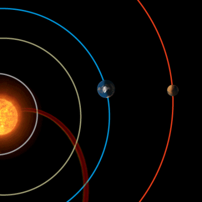
At the time of writing there were nine active regions visible on the Sun bringing a solar flux index of 143 and a sunspot number of 123, although for software prediction purposes you are better off using August’s current smoothed sunspot number of 84.
The sunspots we do have are mostly clustered around the Sun’s equator, which is quite normal for this point in the solar cycle. That is, we normally associate high-latitude sunspots with the beginning of a new cycle, which is still many years away.
Paul GM4ULS reported a contact suddenly vanishing on 5MHz SSB around 15:30hrs on July 26th. This was caused by a sudden ionospheric disturbance due to an M-class solar flare. An SID usually sounds like someone has just “switched off” the ionosphere, although recovery can be quite quick.
DX to be worked next week includes E51KEE (Cook Islands), YS/WE9G (El Salvador), C6AYM (Bahamas), T2JK (Tuvalu), UK/SP9DLM (Uzbekistan) and OX3LX (Greenland). The Arctic Legends team is now operating as RI0BU (Uedineniya Island) until August 7th.
The higher bands, such as 15 and 10m, currently favour north/south paths, such as UK to South Africa and South America. Twenty metres should be more usable for paths to North America.
NOAA predicts that the Sun’s activity may decline slightly next week. It predicts a solar flux index in the range 120-130. A disturbed solar wind environment will likely return on July 30th due to the prospect of combined positive polarity coronal hole effects and CME arrivals from events that left the Sun on July 26 and 27. An additional disturbance is likely on August 1 with the arrival of an additional CME.
Another geomagnetic disturbance is forecast for August 4th, with a predicted Kp index of four. This should improve over a couple of days, back to a more usual two to three.
VHF and up

The current spells of very hot weather have set their own agenda for radio conditions when it comes to Tropo.
We have a tick for the high pressure, but the extreme temperatures have meant that the Tropo-producing temperature inversions seldom survive the daytime heating over the land and its only coastal stations that remain in the lift conditions during the daytime.
The weather forecast models for the coming period suggest that the weather pattern is trying to become more unsettled, but as in recent weeks despite the hints, it seems to take a while to materialise in some parts of the country.
However, it will bring two changes for radio activity; one being slightly cooler weather and some showery rain, so a chance of rain scatter and secondly, perhaps less-reliable Tropo as the high pressure weakens. Some potential Tropo paths probably remain from the fragmented elements of high pressure, but it may be rather hit and miss.
Meteor scatter is worth checking out during the next few weeks with two smaller showers, the Southern Delta Aquarids and the Alpha Capricornids peaking at the end of July and the lead-up to the Perseids in mid-August. The solar conditions are still in play for the effects of CMEs from the Sun and the potential for auroras, so that’s another mode to keep on the list.
Lastly, a mention for sporadic-E which continues through August and produced daily North American openings for many last week. Jet streams are often the driving force for turbulence in the lower atmosphere, and can influence the location of Es. In the coming week they will probably not help greatly due to a very weak pattern over Europe. It’s still worth checking out during the two usual windows of activity in the mid-morning and late afternoon.
For EME operators, Moon declination is increasing again with consequent Northern hemisphere increases in Moon window length and peak Moon elevation. Path losses will decrease as the week progresses towards perigee on August 10th. 144 MHz sky noise is low to moderate all week.
G3YLA JIM


Please read
user notes on website.

G0KYA STEVE
Communications and PR for hi-tech and aerospace companies
STEVE 's Beacon List
G3USF's Worldwide List of HF Beacons
G3USF's Worldwide List Of 50MHz Beacons


Understanding Solar Indices


